nʕaylintn (McIntyre Bluff)
About
What It Is
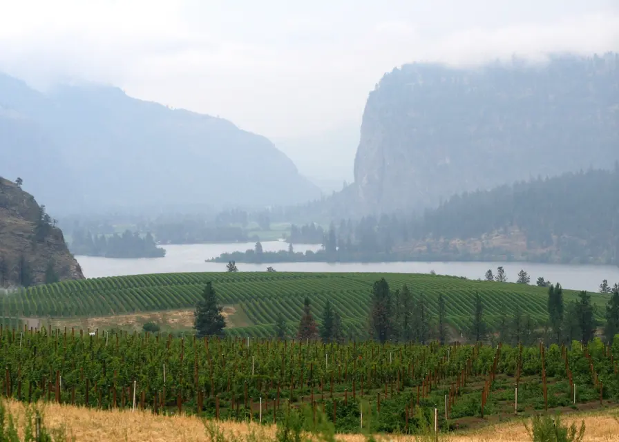
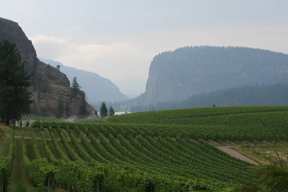
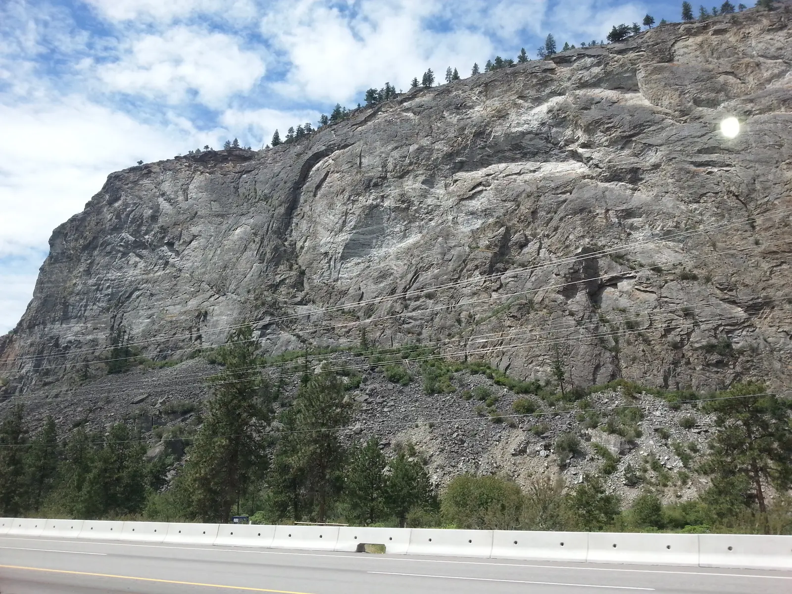
nʕaylintn (pronounced nye-lin-tin) is a large rock formation rising approximately 300 metres above Highway 97 and Vaseux Lake, situated between Okanagan Falls and Oliver in the Okanagan Valley of British Columbia, Canada [3]. The formation consists primarily of granitic gneiss, shaped by glacial activity over at least the last million years, and includes a sheer cliff face, scree, and a gentler western slope [1][3]. Most of the bluff falls within the White Lake Grasslands Protected Area, which protects the dry forest and antelope-brush shrubsteppe ecosystem on and around it [2]. The site was officially renamed from McIntyre Bluff to nʕaylintn on 7 August 2015, following a request from the Osoyoos Indian Band as part of an agreement with the British Columbia Ministry of Environment [1][2].
The name nʕaylintn means Storyteller in the nsyilxcen (Okanagan) language, a reference to a human profile visible on the southeast corner of the cliff face [1][3]. The site holds deep cultural significance for the Osoyoos Indian Band and other Syilx peoples, serving historically as a lookout, a place associated with recorded battles, and an ongoing place of worship [1]. It is also registered on the Regional District of Okanagan Similkameen Community Heritage Register, with registration dated 19 March 2009 [1].
Activities & Experiences
Visitors can hike to the summit of nʕaylintn, where panoramic views of vineyards, orchards, Vaseux Lake, and the surrounding mountains are available [3]. The summit area is described as flat, rocky, and grassy, offering unobstructed sightlines across the valley [3]. Pictographs can be found at the base of the cliffs [2]. The western slope, within the White Lake Grasslands Protected Area, provides habitat for provincially red- and blue-listed species and represents a transitional ecosystem of ecological interest [1].
Practical Access
The town of Oliver is approximately a 10-minute drive from the bluff [3]. Two hiking trails historically led to the summit; however, the route via Covert Farms Family Estate has been closed since March 2020, and as of November 2022 there were no plans to reopen it [3]. The open trail is described as 10 km return with 375 to 424 metres of elevation change, rated low to moderate difficulty, and typically taking 3 to 3.5 hours to complete [3]. No fees, hours, or reservation requirements are stated in the sources for the currently accessible trail.
Restrictions
Dogs are permitted on the hiking trail but must be kept on a leash [3]. The trail via Covert Farms has been closed since March 2020 and, as of November 2022, remains closed with no confirmed reopening date [3]. The western slope is part of a protected area containing habitat for at-risk species, which implies sensitivity to disturbance, though specific prohibited activities within that zone are not detailed in the sources.
What Makes It Distinctive
nʕaylintn marks the northernmost point of the Great Basin Desert, making it a visible boundary between two distinct ecological zones in British Columbia [1]. Its geological history as the site of a natural glacial dam — the southern terminus of glacial Lake Oliver — gives it unusual scientific significance, with associated features such as hanging shelves, benches, and McIntyre Canyon visible in the surrounding landscape [1]. The site is simultaneously a registered heritage landmark, an active place of worship for the Osoyoos Indian Band, a protected grasslands area, and a hiking destination, combining cultural, scientific, and recreational value in a single location [1][2][3].
Sources
- Open year-round
Access & fees
- free entry
Things to do
- panoramic valley views
- summit hiking
- wildlife and flora viewing
Before you go
- covert farms trail closed
Best time to visit
- wildflowers on covert farms route
Features
- cliff height 300 m
- cultural site osoyoos indian band
- former glacial dam site
- gneiss rock ridge
- heritage registered
- indigenous cultural landmark
- name meaning: storyteller
- northernmost point great basin desert
- pictographs at cliff base
- protected dry-forest ecosystem
- renamed 7 august 2015
- rock type: granitic gneiss
- within protected area
Nearby
- mcintyre canyon
- okanagan falls and oliver
- vaseux lake
Good to know
- dogs allowed on leash
- hike difficulty: low–moderate
- nearest town oliver, bc
- official name change 2015
- typical hike duration 3–3.5 hrs
Photos